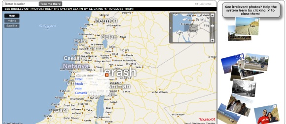
TagMaps is an interesting Yahoo project that tries to visualize tags on a map. World Explorer uses TagMaps to show Flickr photos on a map. "The World Explorer engine analyzes the information tied to the photos (such as location and tags) to find the main "attractions" in each location and in every zoom level and compute their "importance". (...) Think of World Explorer as the automatically-generated, visually-rich guide to the planet."
The search feature doesn't work very well, so you'd better use the initial tags or the suggested tags to explore the map. Not all the photos will be interesting, but you can click on the red "x" sign to remove them and improve the system.
There's also a view for photos taken at night and a way to embed the custom map into your site.
{ Thank you, A. Klauser. }
No comments:
Post a Comment